Figure 7
Management and use of Ash in Britain from the Prehistoric to the Present: Some implications for its Preservation
Jim Pratt*
Published: 23 January, 2024 | Volume 8 - Issue 1 | Pages: 001-011
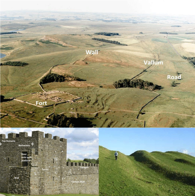
Figure 7:
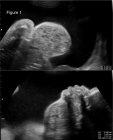
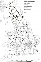
Figure 7: The northern Frontier of Roman Britain. Aerial view East over the Roman fort of Housesteads, on Hadrian's wall. The curtain wall lies along the north wall of the fort and stretches to the horizon. The Vallum runs almost parallel to the Wall itself and forms the southern edge of the militarised zone. To the south of the Vallum, the (later) Roman military road joining all the forts on the wall is evident in this aerial photograph. (Photograph by kind permission of Air Images Ltd). A reconstructed turret at Vindolanda Roman Fort attached to a short length of the curtain wall
illustrates around 30m of the 117 km frontier that makes up Hadrian’s Wall.
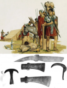
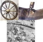
The massive earth-moving needed to create the 112 km length of the Vallum is evident in the insert below right, all the more impressive when it is realised that it was dug by hand using dolabra, wooden shovels tipped with iron, and moved in baskets and carts.
Read Full Article HTML DOI: 10.29328/journal.acee.1001059 Cite this Article Read Full Article PDF
More Images
Similar Articles
-
Removal of Chromium from Aqueous Solution by Thermally Treated Mgal Layered Double HydroxideDashkhuu Khasbaatar*,Enkhtur Otgonjargal,Byambasuren Nyamsuren,Enkhtuul Surenjav,Gunchin Burmaa,Jadambaa Temuujin. Removal of Chromium from Aqueous Solution by Thermally Treated Mgal Layered Double Hydroxide. . 2017 doi: 10.29328/journal.acee.1001001; 1: 001-008
-
Thermal Stress Analysis of a Continuous Rigid Frame BridgeYafei Xu*,Shiwei Ge,Xiao Zhou,Shangyu Peng. Thermal Stress Analysis of a Continuous Rigid Frame Bridge. . 2017 doi: 10.29328/journal.acee.1001002; 1: 009-019
-
Wave Forces on Vertical Structures in Shallow Water: Numerical EvaluationFabio Dentale*,Ferdinando Reale,Angela Di Leo,Eugenio Pugliese Carratelli,Marina Monaco. Wave Forces on Vertical Structures in Shallow Water: Numerical Evaluation. . 2017 doi: 10.29328/journal.acee.1001003; 1: 020-033
-
A Preliminary Laboratory Investigation of Methane Generation Potential from Brewery Wastewater using UASB ReactorMA Karim*,Benjamin L Moss. A Preliminary Laboratory Investigation of Methane Generation Potential from Brewery Wastewater using UASB Reactor. . 2017 doi: 10.29328/journal.acee.1001004; 1: 034-041
-
Hydraulic jump experiment in a rectangular open channel flumeMostafa M El-Seddik*. Hydraulic jump experiment in a rectangular open channel flume. . 2017 doi: 10.29328/journal.acee.1001005; 1: 042-048
-
Natural and effective ways of purifying lake waterSavita Dixit*,Swapnil Lokhande. Natural and effective ways of purifying lake water. . 2017 doi: 10.29328/journal.acee.1001006; 1: 049-054
-
Rapid Microbial Growth in Reusable Drinking Water BottlesQishan Liu*,Hongjun Liu. Rapid Microbial Growth in Reusable Drinking Water Bottles. . 2017 doi: 10.29328/journal.acee.1001007; 1: 055-062
-
Cumulative Effect Assessment: preliminary evaluation for Environmental Impact Assessment procedure and for environmental damage estimationMarco Ostoich*,Andrea Wolf. Cumulative Effect Assessment: preliminary evaluation for Environmental Impact Assessment procedure and for environmental damage estimation. . 2017 doi: 10.29328/journal.acee.1001008; 1: 063-090
-
Automatic control and protection of Coal Conveyor System using PICDhamodharan K*,Mumtaj S,Hari Prasad K,Kamesh Gautham B. Automatic control and protection of Coal Conveyor System using PIC. . 2018 doi: 10.29328/journal.acee.1001009; 2: 001-005
-
Use of Geosynthetic materials in solid waste landfill design: A review of geosynthetic related stability issuesMA Karim*,Lin Zhao. Use of Geosynthetic materials in solid waste landfill design: A review of geosynthetic related stability issues. . 2018 doi: 10.29328/journal.acee.1001010; 2: 006-015
Recently Viewed
-
Success, Survival and Prognostic Factors in Implant Prosthesis: Experimental StudyEpifania Ettore*, Pietrantonio Maria, Christian Nunziata, Ausiello Pietro. Success, Survival and Prognostic Factors in Implant Prosthesis: Experimental Study. J Oral Health Craniofac Sci. 2023: doi: 10.29328/journal.johcs.1001045; 8: 024-028
-
Agriculture High-Quality Development and NutritionZhongsheng Guo*. Agriculture High-Quality Development and Nutrition. Arch Food Nutr Sci. 2024: doi: 10.29328/journal.afns.1001060; 8: 038-040
-
A Low-cost High-throughput Targeted Sequencing for the Accurate Detection of Respiratory Tract PathogenChangyan Ju, Chengbosen Zhou, Zhezhi Deng, Jingwei Gao, Weizhao Jiang, Hanbing Zeng, Haiwei Huang, Yongxiang Duan, David X Deng*. A Low-cost High-throughput Targeted Sequencing for the Accurate Detection of Respiratory Tract Pathogen. Int J Clin Virol. 2024: doi: 10.29328/journal.ijcv.1001056; 8: 001-007
-
A Comparative Study of Metoprolol and Amlodipine on Mortality, Disability and Complication in Acute StrokeJayantee Kalita*,Dhiraj Kumar,Nagendra B Gutti,Sandeep K Gupta,Anadi Mishra,Vivek Singh. A Comparative Study of Metoprolol and Amlodipine on Mortality, Disability and Complication in Acute Stroke. J Neurosci Neurol Disord. 2025: doi: 10.29328/journal.jnnd.1001108; 9: 039-045
-
Development of qualitative GC MS method for simultaneous identification of PM-CCM a modified illicit drugs preparation and its modern-day application in drug-facilitated crimesBhagat Singh*,Satish R Nailkar,Chetansen A Bhadkambekar,Suneel Prajapati,Sukhminder Kaur. Development of qualitative GC MS method for simultaneous identification of PM-CCM a modified illicit drugs preparation and its modern-day application in drug-facilitated crimes. J Forensic Sci Res. 2023: doi: 10.29328/journal.jfsr.1001043; 7: 004-010
Most Viewed
-
Evaluation of Biostimulants Based on Recovered Protein Hydrolysates from Animal By-products as Plant Growth EnhancersH Pérez-Aguilar*, M Lacruz-Asaro, F Arán-Ais. Evaluation of Biostimulants Based on Recovered Protein Hydrolysates from Animal By-products as Plant Growth Enhancers. J Plant Sci Phytopathol. 2023 doi: 10.29328/journal.jpsp.1001104; 7: 042-047
-
Sinonasal Myxoma Extending into the Orbit in a 4-Year Old: A Case PresentationJulian A Purrinos*, Ramzi Younis. Sinonasal Myxoma Extending into the Orbit in a 4-Year Old: A Case Presentation. Arch Case Rep. 2024 doi: 10.29328/journal.acr.1001099; 8: 075-077
-
Feasibility study of magnetic sensing for detecting single-neuron action potentialsDenis Tonini,Kai Wu,Renata Saha,Jian-Ping Wang*. Feasibility study of magnetic sensing for detecting single-neuron action potentials. Ann Biomed Sci Eng. 2022 doi: 10.29328/journal.abse.1001018; 6: 019-029
-
Pediatric Dysgerminoma: Unveiling a Rare Ovarian TumorFaten Limaiem*, Khalil Saffar, Ahmed Halouani. Pediatric Dysgerminoma: Unveiling a Rare Ovarian Tumor. Arch Case Rep. 2024 doi: 10.29328/journal.acr.1001087; 8: 010-013
-
Physical activity can change the physiological and psychological circumstances during COVID-19 pandemic: A narrative reviewKhashayar Maroufi*. Physical activity can change the physiological and psychological circumstances during COVID-19 pandemic: A narrative review. J Sports Med Ther. 2021 doi: 10.29328/journal.jsmt.1001051; 6: 001-007

HSPI: We're glad you're here. Please click "create a new Query" if you are a new visitor to our website and need further information from us.
If you are already a member of our network and need to keep track of any developments regarding a question you have already submitted, click "take me to my Query."


